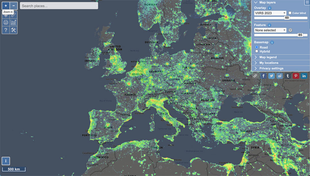
Light Pollutio Map (LPM) is a mapping application that displays light pollution related content over Microsoft Bing base layers (road and hybrid Bing maps).
The primary use was to show VIIRS/DMSP data in a friendly manner, but over the many years it received also some other interesting light pollution related content like SQM/SQC measurements, World Atlas 2015 zenith brigtness, almost realtime clouds , aurora prediction and IAU observatories features.
Link to the Tool: https://www.lightpollutionmap.info/