Jun 6, 2024 | Cartography & Spatial Thinking, Digital, English, GIS for Earth Sciences, Green, Lower Secondary (12-15 years), Spatial, Tools, up to 1h, Upper Secondary (15-18 years)
The PurpleAir map website provides real-time air quality data using a network of sensors placed globally.

Jun 6, 2024 | Cartography & Spatial Thinking, Digital, English, EO, RS & Sat Apps, GIS for Earth Sciences, Green, Lower Secondary (12-15 years), Map Storytelling, Spatial, Tools, up to 1h, Upper Secondary (15-18 years)
Actionable information from Earth Observation to accelerate the Green Transition of society and econom

Jun 6, 2024 | Cartography & Spatial Thinking, Digital, English, French, German, Green, Lower Primary (5-9 years), Other(s), Portuguese, Resources, Spatial, up to 1h, Upper Primary (9-12 years)
Standards-based inquiry exercises designed to teach material based on maps found in widely used textbooks.

May 20, 2024 | Bulgarian, Cartography & Spatial Thinking, Digital, English, EO, RS & Sat Apps, French, German, GIS for Earth Sciences, Greek, Green, Lower Primary (5-9 years), Lower Secondary (12-15 years), Map Storytelling, Other(s), Portuguese, Resources, Spatial, Swedish, Upper Secondary (15-18 years)
A user-friendly interactive map-based educational tool on the ocean.

May 20, 2024 | Cartography & Spatial Thinking, Digital, English, EO, RS & Sat Apps, French, German, GIS for Earth Sciences, Green, Lower Primary (5-9 years), Lower Secondary (12-15 years), Map Storytelling, Other(s), Portuguese, Resources, Spatial, Upper Secondary (15-18 years)
Online initiative for the use of Google Earth services in the Classroom.

May 20, 2024 | Cartography & Spatial Thinking, Digital, English, EO, RS & Sat Apps, GIS for Earth Sciences, Green, Lower Primary (5-9 years), Lower Secondary (12-15 years), Map Storytelling, Resources, Spatial, Upper Secondary (15-18 years)
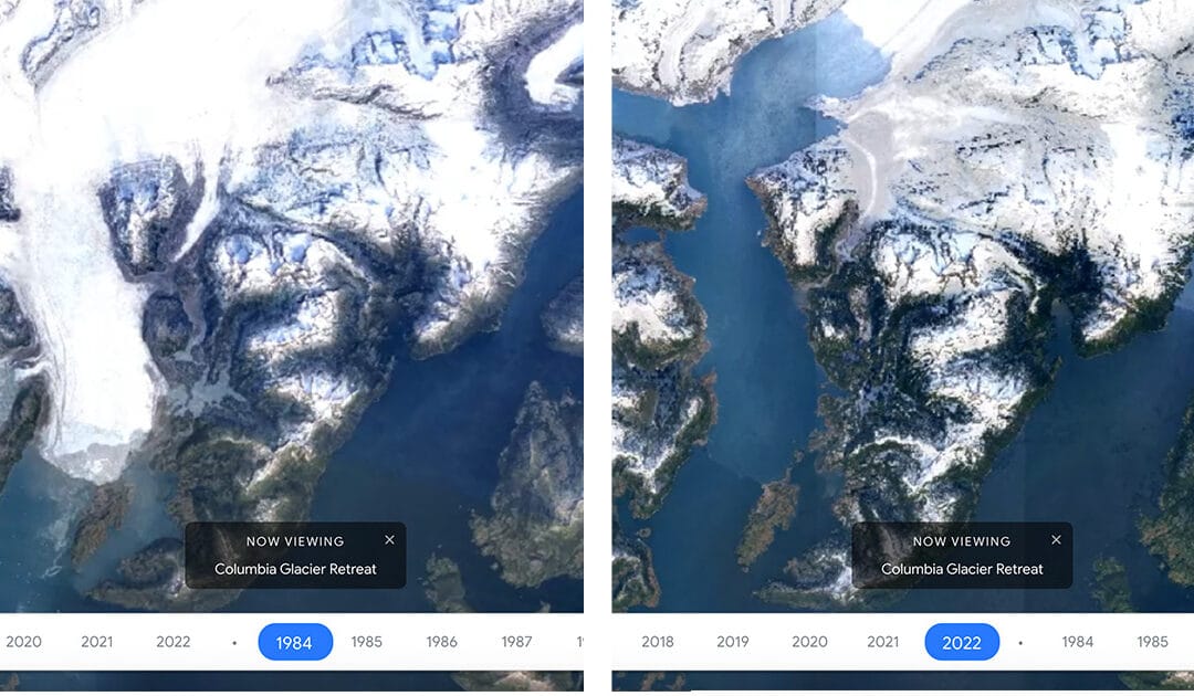
Google Earth Timelapse is a global, zoomable video that lets users see how the Earth has changed since 1984.


