Mar 30, 2026 | Age Group, Cartography & Spatial Thinking, Coding for Urban Sustainability, Content Type, Digital, English, EO, RS & Sat Apps, Geo-Concept, GIS for Earth Sciences, Green, Language, Lower Primary (5-9 years), Lower Secondary (12-15 years), Map Storytelling, Presentation, Skills, Spatial, up to 1h, Upper Primary (9-12 years), Upper Secondary (15-18 years)
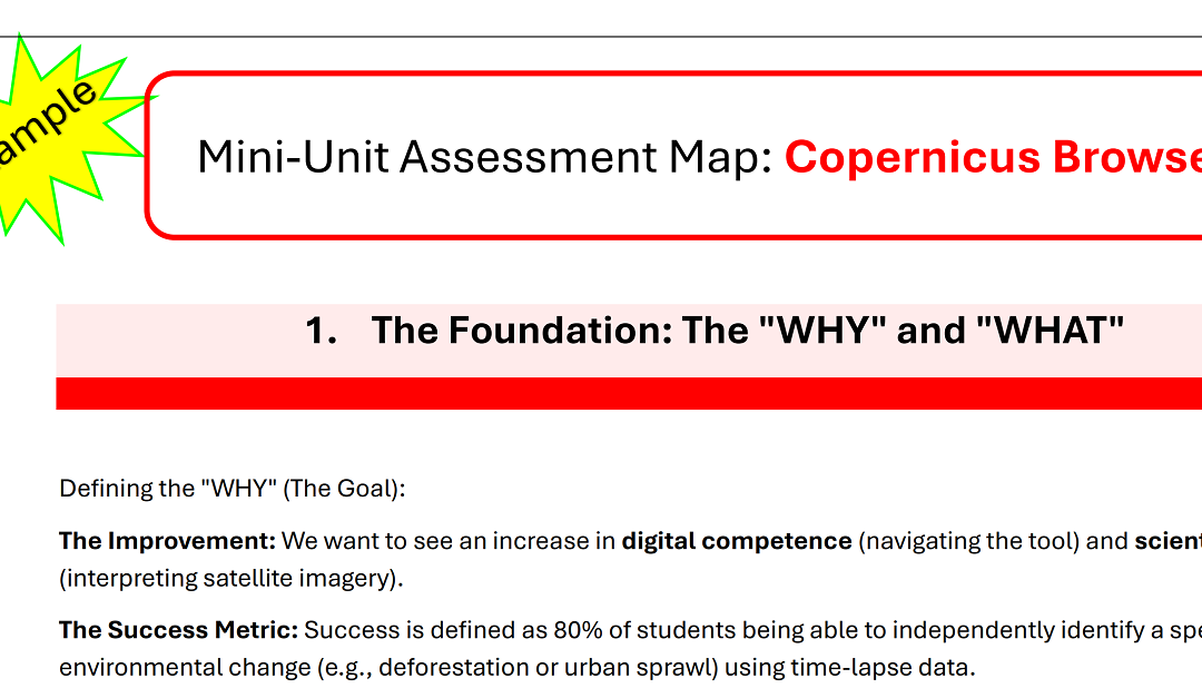
The UCF (Unified Competence Framework) and the problem of a valid Assessment procedure. A “Mini-Unit Assessment Map” is a strategic blueprint that ensures your teaching goals, student activities, and assessment methods are perfectly aligned. The blueprint...
Feb 26, 2026 | English, EO, RS & Sat Apps, Lower Secondary (12-15 years), Online course, Presentation, up to 1h, Upper Primary (9-12 years), Upper Secondary (15-18 years)
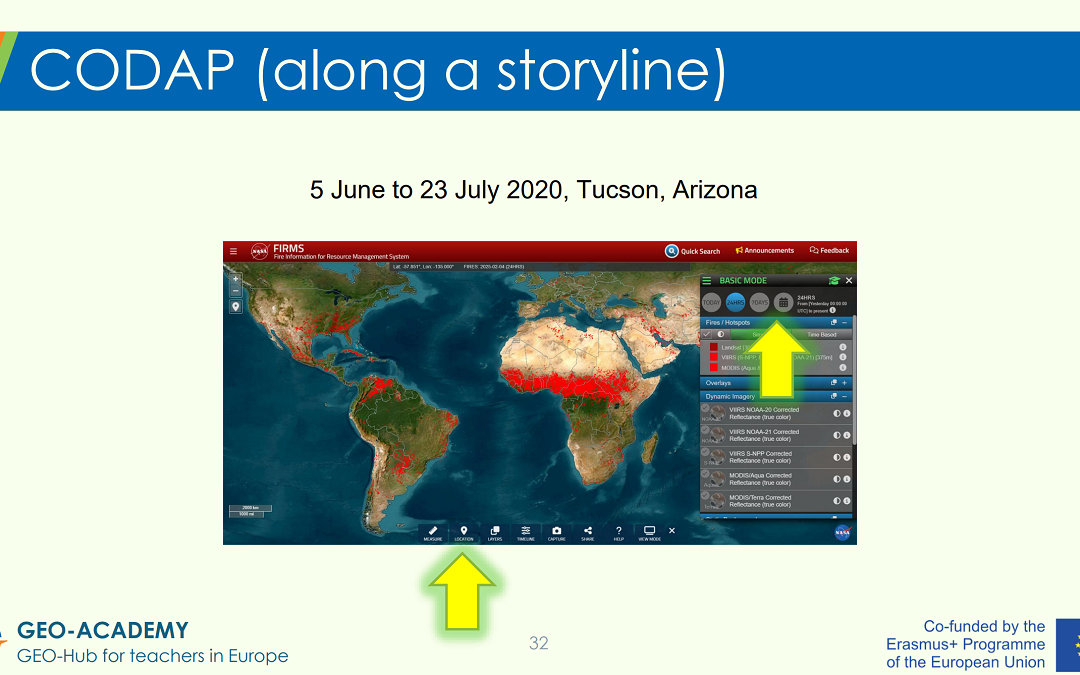
EO, RS, Sat Apps – Tutorial in a Nutshell: The tutorial provides a guided “tour” of selected GEO-Academy resources and practical classroom applications. These include the Eratosthenes experiment, data analysis activities using CODAP (Common Online Data Analysis...
Sep 30, 2025 | 2-3h, Age Group, Cartography & Spatial Thinking, Coding for Urban Sustainability, Digital, EO, RS & Sat Apps, GIS for Earth Sciences, Green, Lifelong Learning, Lower Primary (5-9 years), Lower Secondary (12-15 years), Map Storytelling, more than 3h, Resources, Skills, Spatial, Tools, up to 1h, Upper Primary (9-12 years), Upper Secondary (15-18 years)
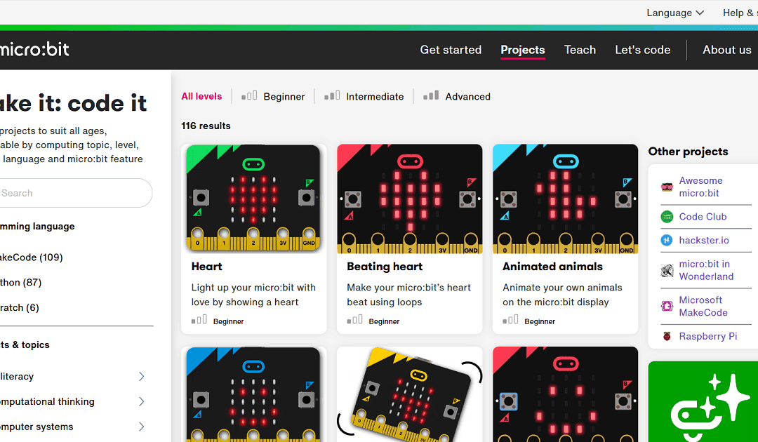
The “Make it: code it” section of the micro:bit site is a rich, teacher-friendly library of coding project ideas, tailored to all levels from beginner through advanced. It offers over 100 ready-made micro:bit projects you can filter by programming language (MakeCode,...
May 14, 2025 | 2-3h, Cartography & Spatial Thinking, Digital, English, German, Greek, Green, Lower Primary (5-9 years), Lower Secondary (12-15 years), Map Storytelling, more than 3h, Other(s), Resources, Spatial, Tools, up to 1h, Upper Primary (9-12 years), Upper Secondary (15-18 years)
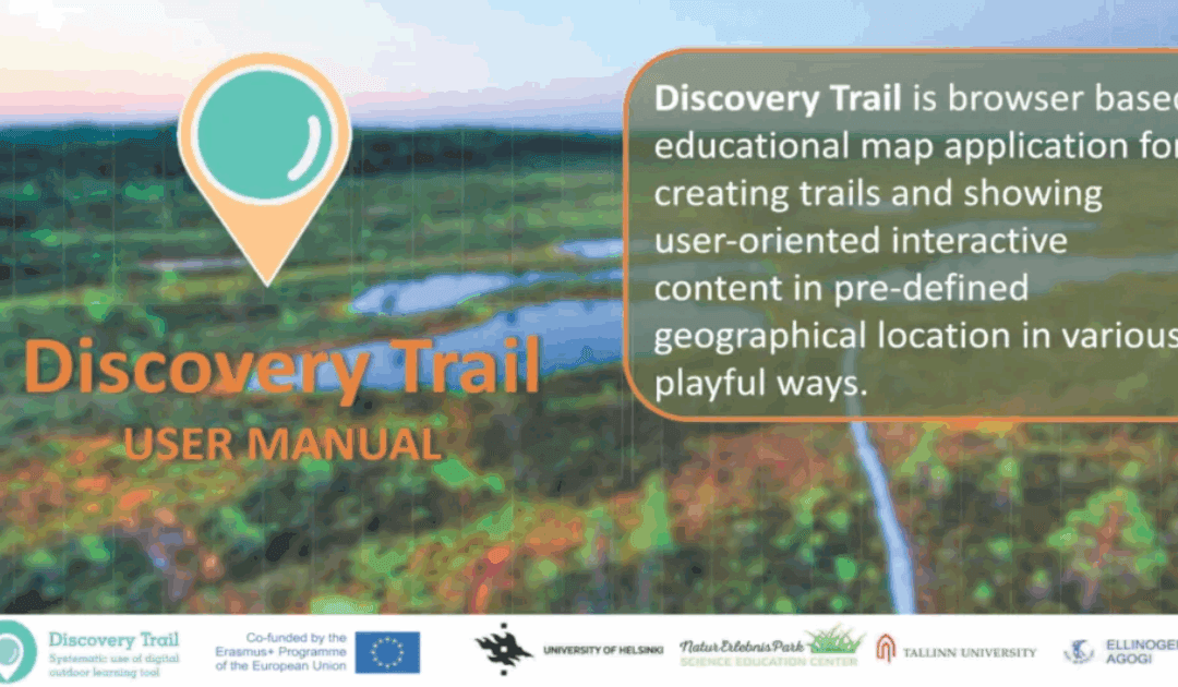
Discovery Trail simplifies the process of combining technology with outdoor learning, offering a dynamic and interactive way for students to explore their environment. This happens with its app called “Avastusrada”. Avastusrada is a digital tool that...
Dec 2, 2024 | 2-3h, Cartography & Spatial Thinking, Digital, English, EO, RS & Sat Apps, GIS for Earth Sciences, Green, Lifelong Learning, Lower Primary (5-9 years), Lower Secondary (12-15 years), Map Storytelling, more than 3h, Portuguese, Resources, Skills, Spatial, up to 1h, Upper Primary (9-12 years), Upper Secondary (15-18 years)
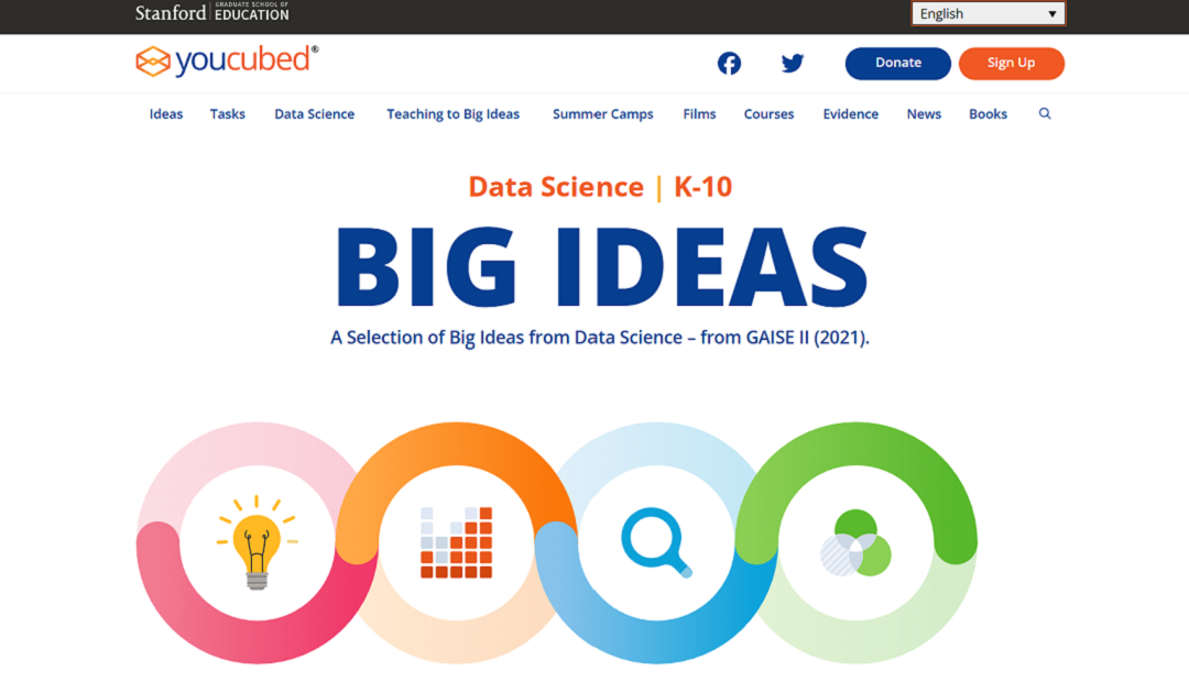
“Big Ideas from Data Science” is a framework developed by YouCubed to help students and educators engage with key concepts in data science. It highlights six foundational ideas, such as recognizing variability, understanding data structures, and...
Jun 6, 2024 | Cartography & Spatial Thinking, Digital, English, EO, RS & Sat Apps, French, GIS for Earth Sciences, Green, Lower Secondary (12-15 years), Other(s), Portuguese, Spatial, Tools, up to 1h, Upper Secondary (15-18 years)
Global Forest Watch is a valuable tool for anyone interested in forest conservation, environmental protection, and sustainable development.