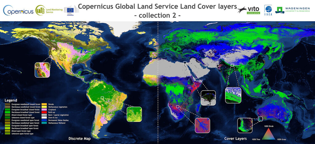
View or download Global Land Cover products, at 100m resolution, including the main classification (23 classes), fractional cover for the ten base classes, a forest type layer and quality indicators.
Whether you’re monitoring crops, modelling green energy installations or soil sealing, combatting loss of natural resources or just helping countries meet their Sustainable Development Goals, chances are high that you’ll need an accurate and spatially detailed map on land cover and land use. Earth Observation satellites, like those from EU’s flagship programme Copernicus, are key to providing such maps, at a global scale, with free and open access.
To this end, the team from the Global component of the Copernicus Land Monitoring Service systematically produces global maps of land cover & cover changes and related surface area statistics.
This tool aims to visualize those global land cover change maps and statistics and allows to easily navigate and compare between different areas or years.
Compare and export Land Cover statistics per administrative area.
Link to the Tool: https://lcviewer.vito.be/