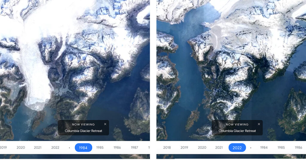
Google Earth Timelapse is a global, zoomable video that lets users see how the Earth has changed since 1984. It allows you to see almost four decades of changes on planet Earth on video, highlighting the impact of various factors, such as climate change. The interactive 4D map is made from millions of satellite photographs and has now been updated with images from 2021 and 2022.
The journey through time shows us how the earth’s surface has visually evolved with urban sprawl, mining impacts, river meanders, the growth of megacities, deforestation, and agricultural expansion.
Link to the resource: https://earthengine.google.com/timelapse
