Lesson Plan: Tracing Ancient Routes – A Spatial Exploration of the Past | UCF-3.2.2
Tracing Ancient Routes – A Spatial Exploration of the Past
Ancient routes are a rich and authentic way to teach spatial skills through history, geography, and Earth observation. Whether it’s the Silk Road, Roman roads, Inca trails, or ancient pilgrimage routes, these networks require students to think in terms of scale, distance, terrain, and human-environment interaction — all of which build spatial thinking.
Lesson Objectives
By the end of the lesson, students will be able to:
- Analyze ancient trade or migration routes using maps and satellite imagery.
- Apply spatial skills such as mental mapping, route planning, and topographical analysis.
- Reflect on how geography shaped human decisions and settlements.
Lesson Structure
1) Hook (10 min) – “What Makes a Good Route?”
- Ask: “If you had to walk across a continent with no modern roads, what would you look for?”
- Students brainstorm in small groups: water sources, flat land, mountain passes, climate, danger zones, etc.
- Discuss briefly how ancient people chose paths.
Spatial Skills: Orientation, environmental perception, distance estimation.
2) Introduce the Ancient Route (10–15 min)
Pick one key historical route, such as:
- Silk Road (Asia)
- Roman Roads (Europe)
- Trans-Saharan Trade Routes (Africa)
- Camino de Santiago (Europe)
- Inca Trail (South America)
- Viking sea routes
Show:
- A map of the route (ancient + modern overlay).
- A satellite view (Google Earth or EO Browser).
- Photos of terrain (mountains, rivers, oases, etc.).
Spatial Focus: Landforms, elevation, climate zones.
3) Map-Based Activity: Reconstruct the Journey (30 min)
Students work in small groups with maps (printed or digital):
Task:
- Trace the route and identify:
- Natural features that guided or blocked travel (rivers, deserts, mountains).
- Strategic stops (cities, water sources, passes).
- Estimations of travel time and challenges.
Extension:
- Use Google Earth or satellite images to annotate the path (layers, pins, elevation profiles).
Spatial Skills:
- Route tracing
- Scale and distance reasoning
- Topographic interpretation
- Spatial inference (why this route, not that one?)
4) Creative Application: You’re the Explorer (20 min)
Students design an alternative route (based on what they’ve learned) using:
- Topographic maps or satellite imagery
- Reasoned arguments about geography, danger, and ease
They present:
- Their new route on a map
- A short explanation: Why is this better or worse?
Spatial Skills: Mental rotation, comparative geography, strategic planning.
Reflection & Discussion – Critical Thinking
- How did people use spatial knowledge before GPS and maps?
- What surprised you about the terrain or original route?
- Connect to today: How do modern routes still depend on geography?
Materials & Tools
- Historical maps of the chosen route
- Access to Google Earth, Sentinel EO Browser, or topographic maps
- Printed maps (for tracing)
- Elevation profile tools (Google Earth “terrain” mode)
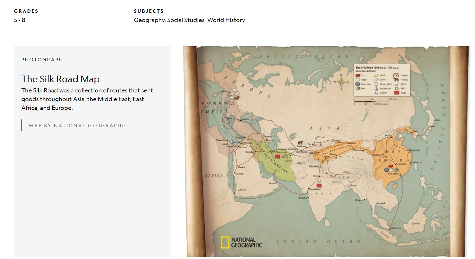
An in-depth look at the example of the Silk Road:
Interactive Maps & Timelines
World History Encyclopedia – Silk Road Interactive Map
Interactive map and well-explained articles about routes, goods, and civilizations involved.
https://www.worldhistory.org/Silk_Road/
National Geographic – The Silk Road: Connecting East and West
Includes video segments, photos, and teacher resources.
https://education.nationalgeographic.org/resource/silk-road
TimeMaps
Animated historical maps showing developments over centuries
https://timemaps.com/

