The cross-disciplinary path to maths
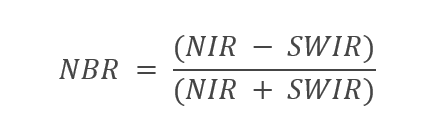
The Normalised Burn Ratio (NBR) index is used to detect burnt areas.
Healthy vegetation has a very high reflectance in the NIR (near infrared) and a low reflectance in the SWIR (shortwave infrared) – the opposite of what is seen in areas destroyed by fire. Recently burnt areas have low reflectance in the NIR and high reflectance in the SWIR, i.e. the difference between the spectral responses of healthy vegetation and burnt areas peaks in the NIR and SWIR regions of the spectrum.
The following list provides a rough overview:
- Typical reflectance values for healthy vegetation in the NIR part of the electromagnetic spectrum are as high as 35% to 50%.
- Typical reflectance values for healthy vegetation in the SWIR part of the electromagnetic spectrum are as low as 5% to 15%.
- Typical reflectance values for burnt areas in the NIR part of the electromagnetic spectrum are as low as 10% to 20%.
- Typical reflectance values for burnt areas in the SWIR part of the electromagnetic spectrum are as high as 40% to 55%.
With the help of a spreadsheet programme, students can practise calculating relevant indexes.
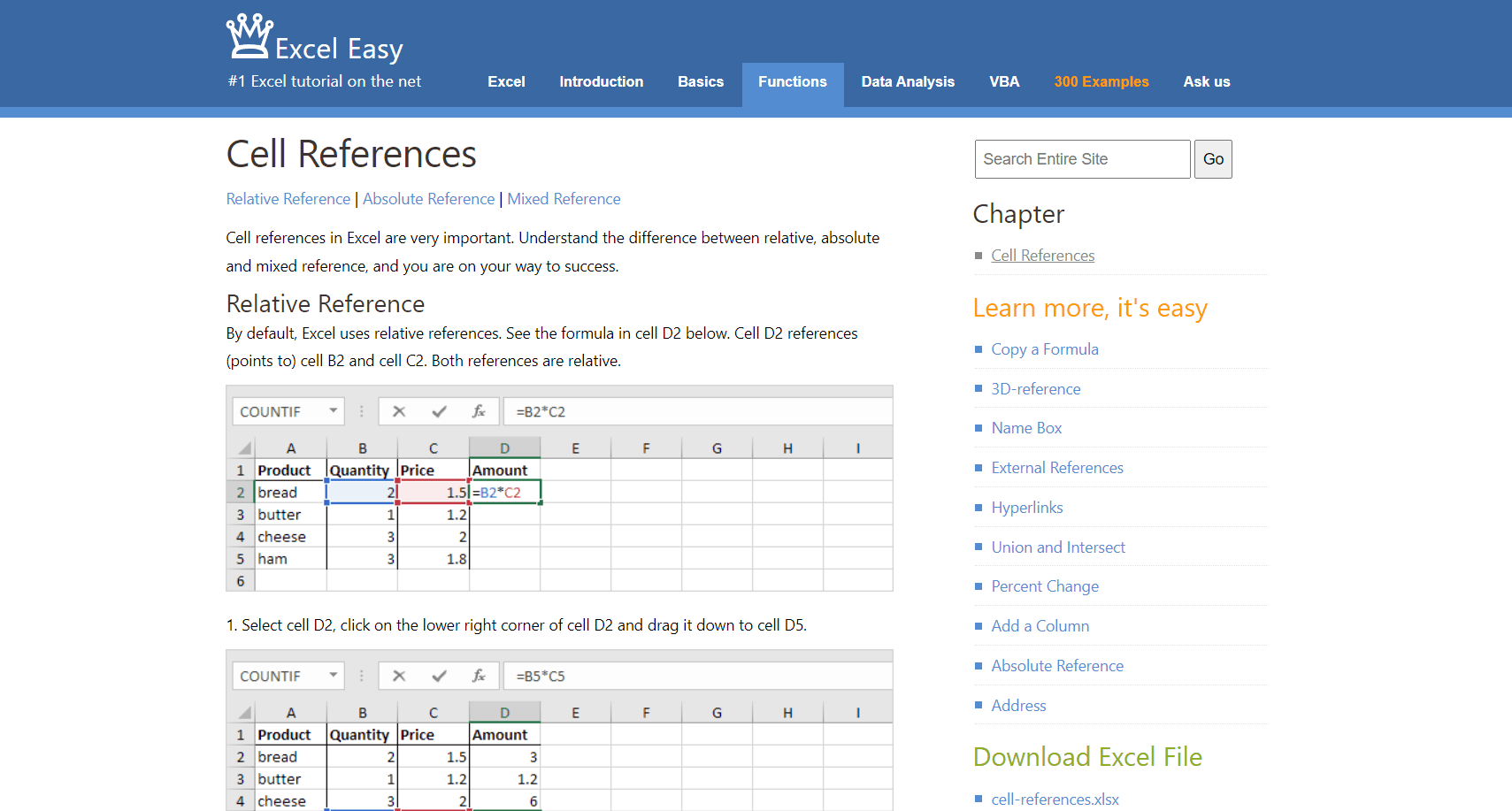
The Microsoft product Excel was used in the following screenshots – but there are a number of freely available alternatives (such as Google Sheets and LibreOffice Calc).
In the spreadsheet program, we will use a simple formula to calculate the Normalised Burn Ratio (NBR):
The following section is not intended as a comprehensive learning unit for a spreadsheet programme. However, there are numerous tutorials for the introduction to the respective programmes on the Internet. The following resource is an example:
https://www.excel-easy.com/functions/cell-references.html
The most important steps are described below with individual screenshots.
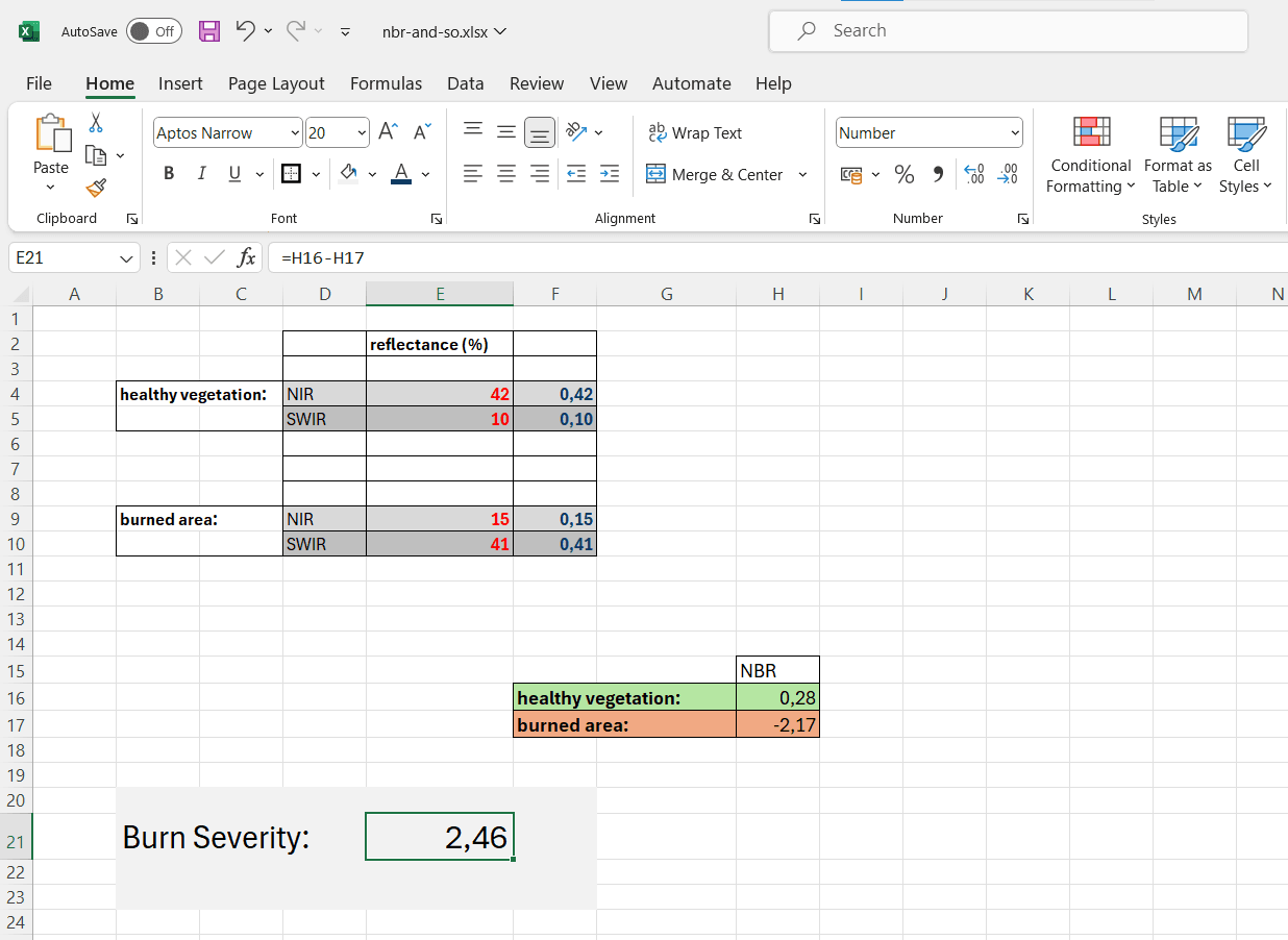
Firstly, the values (satellite data) are entered in a table. For example, a value of 42% was entered for the reflectance in the NIR range for healthy vegetation.

Next, the fraction of the reflected radiation was recorded:
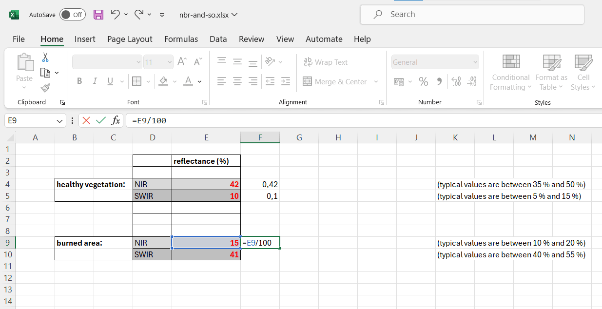
The corresponding values have now been determined in a separate table using the simple formula.

Burn Severity
The difference between the NBR before and after the fire, which is determined from the images, is used to calculate the delta NBR (dNBR or ∆NBR), which can then be used to assess the severity of the fire. A higher dNBR value indicates more severe damage, while areas with negative dNBR values may indicate regrowth after a fire. The formula for calculating dNBR is shown below:
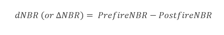
For our example, we obtain a burn severity of 2.46
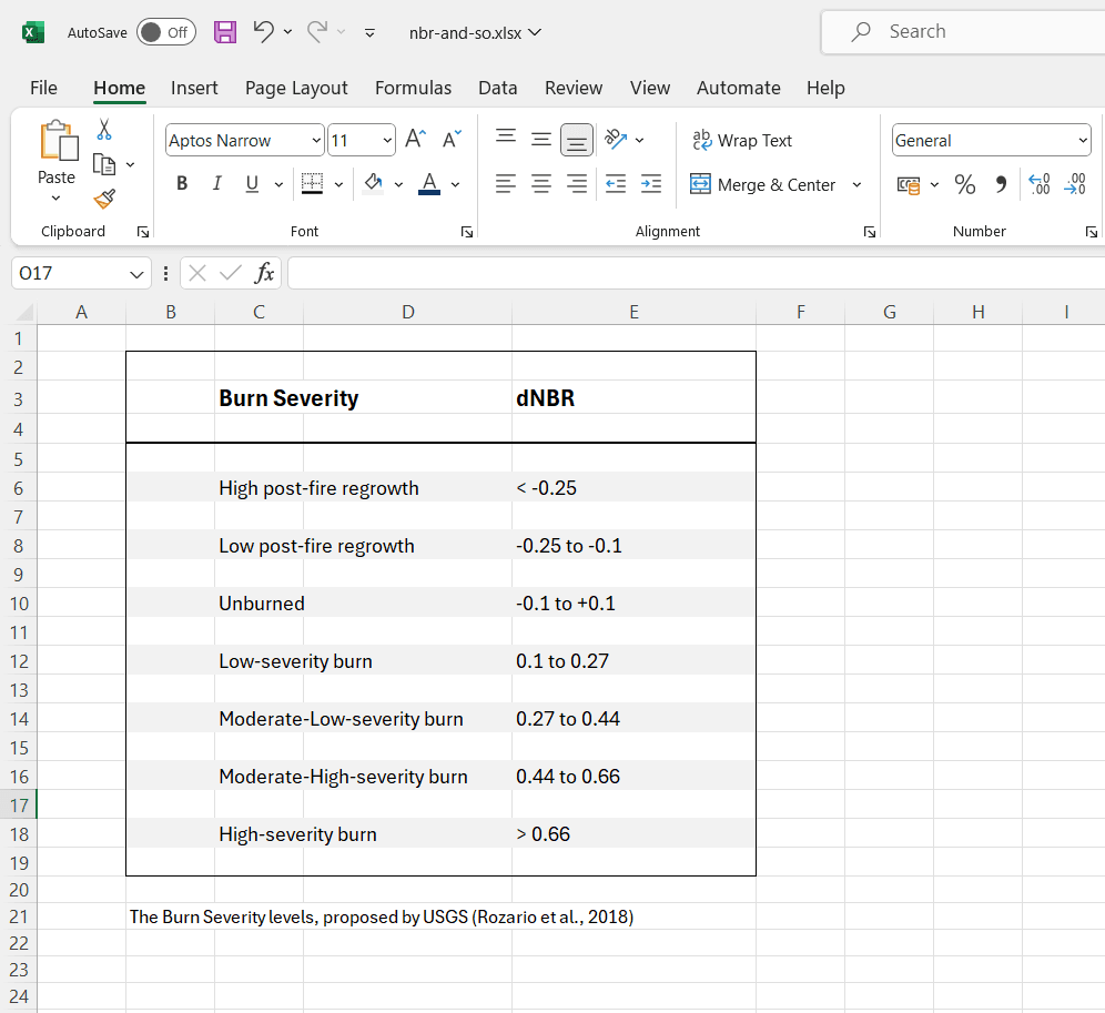
The United States Geological Survey (USGS) proposed a classification table to interpret the burn severity, which can be seen below:
Further information can be found in the references listed here:
https://gsp.humboldt.edu/olm/Courses/GSP_216/lessons/Spectral-Enhancements/NBR.html