Extent and overview of wildfires | RS-EO-SatApp-3.1.1
We frequently hear in the news these days about wildfires breaking out in places where they were previously rare. Larger and more intense wildfires are more common.
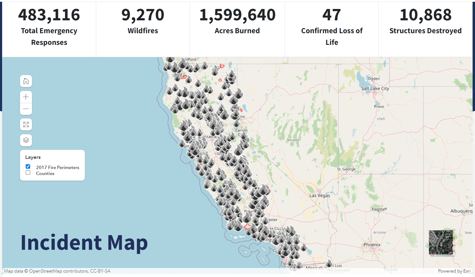
In the summer of 2017, wildfires broke out in Portugal, leaving 66 people dead and more than 500 million EUR in damages. The US state of California was engulfed in flames that same year, as firemen battled over 9000 fires that consumed over 500 hectares.
But numbers and images in the news can also be misleading. People have to make up their own minds.
Wildfires certainly have many negative consequences:
- Threat for human health and lives.
- Damage to human property.
- Release of large amounts of toxic gases into the atmosphere, which in turn contribute to global warming.
But we rarely think about the positive aspects of wildfires, so long as they don’t get out of control:
- Wildfires burn vegetation, returning nutrients like nitrogen to the soil in the form of ash. This process enriches the soil and promotes new plant growth.
- Forest fires promote biodiversity.
- Fires can reduce the prevalence of diseases by destroying infected plants and trees. This helps maintain the health of forests and other ecosystems.
Understanding these benefits highlights the importance of fire management practices that allow for the natural role of fire in maintaining healthy ecosystems while minimizing risks to human life and property.
So it would be good if we had the wildfires firmly under control.
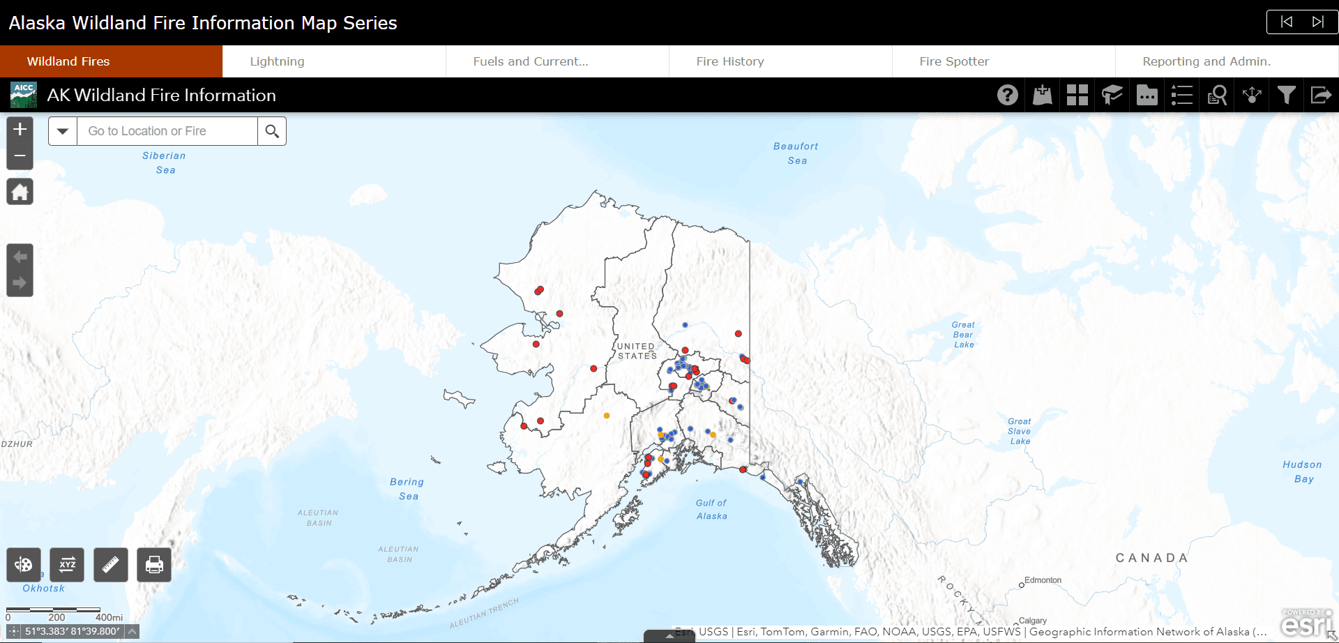
This is exactly what the dashboards of the Alaska Interagency Coordination Centre are all about.
https://www.arcgis.com/apps/dashboards/f3a2b5b11466438e85fffca787542df8
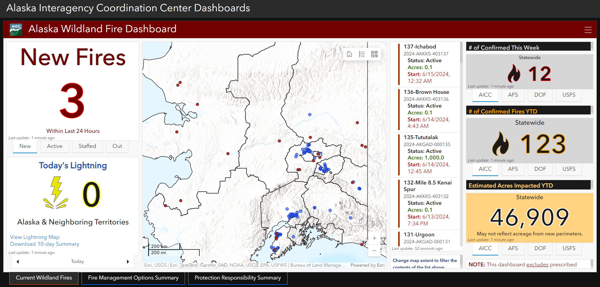
So take a look at the map and try out a few things yourself (zoom in, zoom out, …). Click on the fire location to learn more about the cause, extent and strategy used in this fire.
Try out different things, such as changing the background maps, inserting the legend or displaying the fire history.