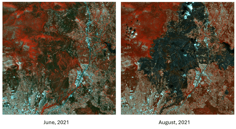
First example: Wildfire in Greece
The human-caused climate crisis has increased the wildfire season across the globe and is responsible for a higher likelihood of fire and bigger burnt areas in southern Europe.
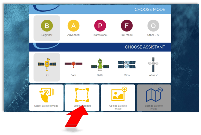
Open the BLIF website (https://server2.blif.de) and select “Cropped Image” …
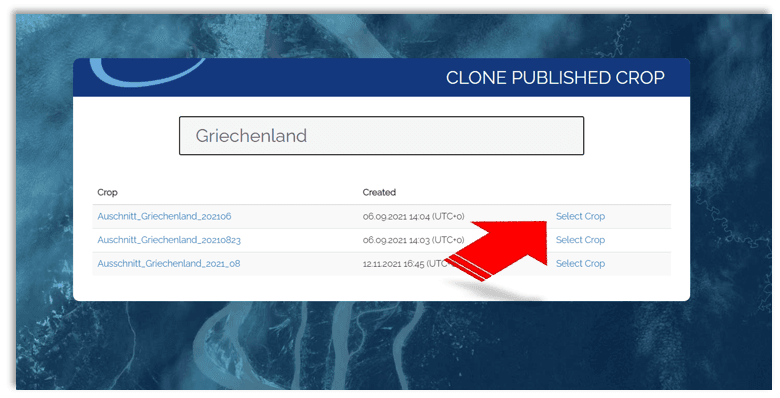
Use the FILTER function to search for “Griechenland” (german for Greece) and select the first entry (wildfire in June 2021: Ausschnitt_Griechenland_202106):
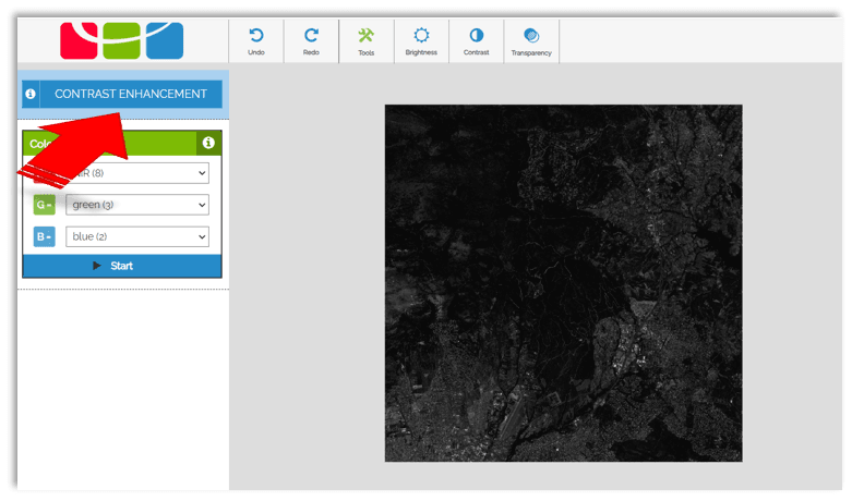
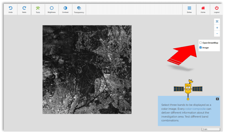
Next, the contrast is increased …
Open another layer – the OpenStreetMap – to identify the area even better:
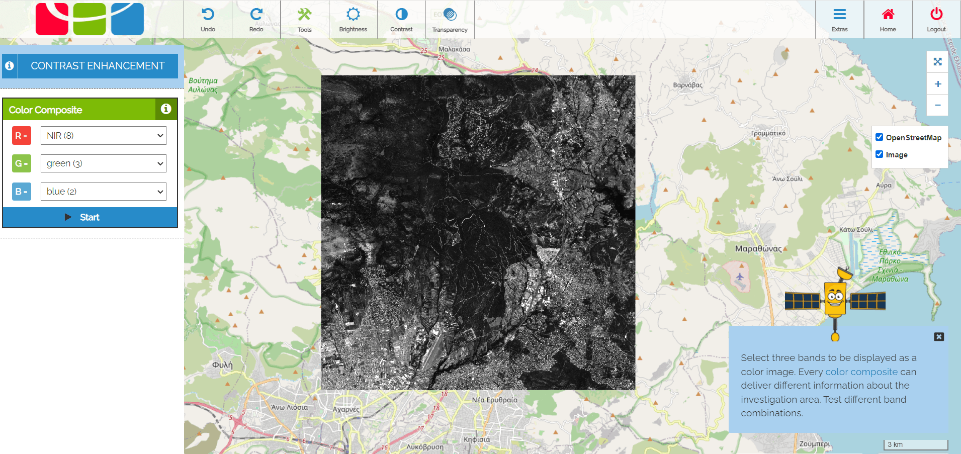
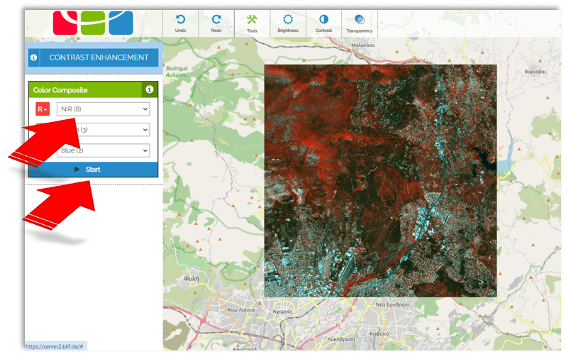
The satellite also detects radiation that the human eye cannot see. The human eye is not able to perceive infrared radiation (IR) – but the satellite can. If you switch the red channel to infrared radiation, all areas with particularly strong infrared radiation are marked red in the satellite image.
Select the NIR band (near IR band) in the colour composite and press the start button to see this:
The whole procedure can now be repeated for a satellite image taken two months later.