Share and Reflect: Mapping Results and Spatial Stories
One possible way to share the results of this activity is by organizing a “Map Fair” or Spatial Exhibition, where students present the maps, routes, and spatial analyses they created during their Cartography and GIS Peddy Paper Adventure. Each group can display a combination of paper maps, digital maps, photographs, and short written reflections that explain their process of exploration and data collection. By comparing different mapping strategies, students will see how diverse perspectives can represent the same space in unique ways, revealing the creative and interpretive nature of cartography.
The exhibition can begin with a short introduction where students explain their research questions and hypotheses. They should describe the area they mapped, the tools they used (compass, GPS, GIS apps), and the challenges faced in orientation and data collection. Encourage them to showcase both their initial hand-drawn sketches and their final georeferenced maps, allowing the audience to visualize how their spatial understanding evolved throughout the process.
Share and Reflect: Mapping Results and Spatial Stories.
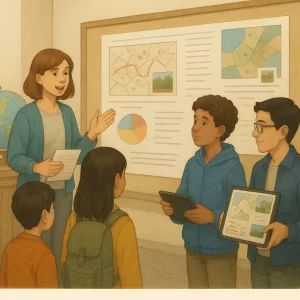
Illustration of students sharing the outcomes of their Cartography and GIS Peddy Paper Adventure
through a classroom exhibition, displaying maps, digital visualizations, and field observations.
The scene highlights communication, collaboration, and the interpretive nature of spatial storytelling.
Credits: Custom educational illustration created for the course
Exploring Spatial Skills and Map Literacy: A Cartography & GIS Peddy Paper Adventure, generated by an AI model..
After these presentations, groups can engage in a reflection dialogue around questions such as:
– How did your perception of the mapped area change after the activity?
– What was easier or harder when using digital maps compared to paper ones?
– How did teamwork influence your ability to interpret and navigate space?
– What skills did you develop that could be useful in everyday life or future careers in geography, engineering, or environmental science?
Students can also publish their digital maps and findings in an online classroom repository or interactive story map, using platforms such as ArcGIS StoryMaps or Google Earth Web Projects. This will allow them to integrate narrative, photos, and geographic layers, transforming their data into a “spatial story” that others can explore. If the school has a website or social media page, the project can be featured to highlight how students used STEM and inquiry methods to understand their local environment.
To conclude, organize a collective reflection session or roundtable discussion where students and teachers share insights about spatial literacy and geographic thinking. Discuss how maps influence decision-making at all levels—from choosing a route to school to planning urban spaces or responding to environmental challenges.
If an in-person event is not feasible, an online webinar or virtual exhibition can be organized. Students can present digital maps and short videos explaining their exploration process, allowing other schools participating in the Geo Academy network to join