GeoAcademy Portal
  • Home
  • Resources and Tools
  • Groups
    • Forums
  • E-modules
    • All Courses
    • Course Profile
  • Events
  • Contact
  • Login
    • Reset Password
    • User Profile
    • User Groups
Select Page
Google Earth Education

Google Earth Education

May 20, 2024 | Cartography & Spatial Thinking, Digital, English, EO, RS & Sat Apps, French, German, GIS for Earth Sciences, Green, Lower Primary (5-9 years), Lower Secondary (12-15 years), Map Storytelling, Other(s), Portuguese, Resources, Spatial, Upper Secondary (15-18 years)

Online initiative for the use of Google Earth services in the Classroom.

Google Earth Timelapse

Google Earth Timelapse

May 20, 2024 | Cartography & Spatial Thinking, Digital, English, EO, RS & Sat Apps, GIS for Earth Sciences, Green, Lower Primary (5-9 years), Lower Secondary (12-15 years), Map Storytelling, Resources, Spatial, Upper Secondary (15-18 years)

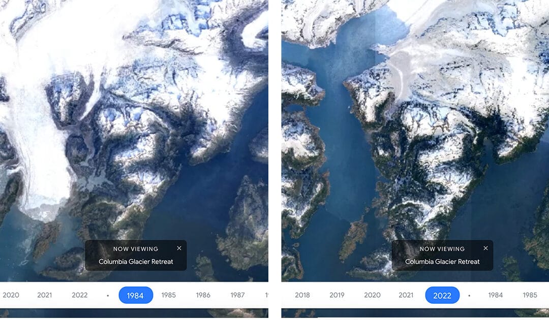
Google Earth Timelapse is a global, zoomable video that lets users see how the Earth has changed since 1984.

Google Earth Stories

Google Earth Stories

May 20, 2024 | Cartography & Spatial Thinking, Digital, English, EO, RS & Sat Apps, French, German, GIS for Earth Sciences, Green, Lower Primary (5-9 years), Lower Secondary (12-15 years), Map Storytelling, Other(s), Portuguese, Resources, Spatial, Upper Secondary (15-18 years)

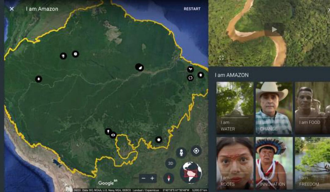
Google Earth repository of stories created for the classroom.

NatGeo Education

NatGeo Education

May 20, 2024 | Cartography & Spatial Thinking, Digital, English, GIS for Earth Sciences, Green, Lower Primary (5-9 years), Lower Secondary (12-15 years), Map Storytelling, Resources, Spatial, Upper Secondary (15-18 years)

Engage with National Geographic Explorers and transform learning experiences through live events, free maps, videos, interactives, and other resources.

Living Atlas of the World

Living Atlas of the World

May 20, 2024 | Cartography & Spatial Thinking, Digital, English, EO, RS & Sat Apps, French, GIS for Earth Sciences, Green, Lower Secondary (12-15 years), Map Storytelling, Other(s), Portuguese, Resources, Spatial, Upper Secondary (15-18 years)

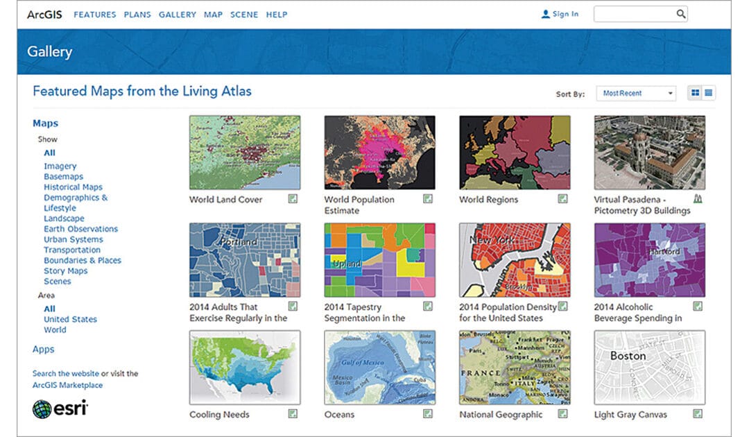
ArcGIS Living Atlas of the World is the foremost collection of geographic information from
around the globe. It includes maps, apps, and data layers to support your work.

senseBox

senseBox

May 20, 2024 | Cartography & Spatial Thinking, Coding for Urban Sustainability, Digital, English, EO, RS & Sat Apps, German, GIS for Earth Sciences, Green, Lower Secondary (12-15 years), Resources, Spatial, Upper Secondary (15-18 years)

A toolkit for digital education, citizen science and environmental monitoring.

« Older Entries
Next Entries »

Geo-Academy Partners

Geo-Academy Partners - Logos

GEO-Academy is a Teachers’ Academy project funded by the Erasmus+ Programme of the European Union. REF: ERASMUS-EDU-2022-PEX-TEACH-ACA under GA No. 101104693. Views and opinions expressed are however those of the author(s) only and do not necessarily reflect those of the European Union or the European Education and Culture Executive Agency (EACEA). Neither the European Union nor the granting authority can be held responsible for them.

  • Follow
  • Follow
  • Follow
  • Follow

Privacy Policy

Cookie Policy

Copyright © 2024 Geo-Academy – All rights reserved